Archive for the 'Mesilla' Category
Tuesday, June 12th, 2018
Hermit of La Cueva Honored with a Statue
A life-sized statue of Giovanni Maria de Agostini has been erected in Capela do Alto, a town in the Brazilain state of São Paulo. Agostini is known in Brazil as João Maria D’Agostini or Monge Giovanni Maria D’Agostini (Monk). In New Mexico he is known as El Ermitaño (The Hermit).
Agostini lived in Brazil from December, 1842, to February, 1852.

Statue of Giovanni Maria de Agostini, Capela do Alto, São Paulo, Brazil.

Statue of Giovanni Maria de Agostini, Capela do Alto, São Paulo, Brazil.

Plaque – Giovanni Maria de Agostini, Capela do Alto, São Paulo, Brazil.
Sunday, October 22nd, 2017
The Hermit of La Cueva – The Movie
A Brazilian film company, Realizart Productions Audiovisual LTDA, is making a documentary about Giovanni Maria de Agostini, the “Hermit of Las Cueva,” based on the book Giovanni Maria de Agostini, Wonder of the Century — The Astonishing World Traveler Who Was A Hermit.
Shooting began in New Mexico in September, 2017. From New Mexico, shooting will move to Brazil, Argentina, Peru, and Italy. Final shooting is expected to be completed in late September, 2018.

Ralf Tambke, Director of Photography (Realizart Productions Audiovisual LTDA), shooting for the documentary “The Hermit of La Cueva” at Dripping Springs Nature Area. The entrance to La Cueva is at the base of the distant rock formation.
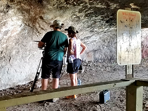
Marcia Paraiso, Film Director, and Ralf Tambke, Director of Photography (Realizart Productions Audiovisual LTDA), shooting for the documentary “The Hermit of La Cueva” in La Cueva (the cave) at Dripping Springs Nature Area.

Shooting the documentary “The Hermit of La Cueva” at San Albino Basilica, Mesilla, New Mexico. Left to right: Juliana Baratieri, Sound Engineer, Marcia Paraiso, Film Director, Dr. Alexandre Karsburg, consultant, Ralf Tambke, Director of Photography (Realizart Productions Audiovisual LTDA).
Giovanni Maria de Agostini was born in Sizzano, Italy, in 1801, the son of poor farm workers. He left home at 21 and spent the next 17 years traveling extensively in Europe. During this time he developed two seemingly contradictory aspirations: a fervent desire to devote his life to “perfect solitude” and an astonishing urge to travel incessantly.
In 1839, Agostini joined a Maronite Christian monastery in Rome, and then immediately left for South America.
In South America Agostini visited Venezuela, Colombia, Ecuador, Bolivia, Peru, Brazil, Argentina, Paraguay, and Chile multiple times. During this spectacular solo Odyssey, he survived a trip down the Amazon River by canoe, crossed the Andes by foot several times, walked vast distances, and endured living alone in scalding deserts and sub-zero mountains. In spite of oppressive and infuriating obstacles, including death threats, unjust arrest, deportation, jail, and forced confinement in a mental asylum, Agostini persisted undeterred in the solemn goal he set for himself when he left Europe.
After 21 years in South America, Agostini traveled to Mexico, Cuba, and the United States. After arriving in New York, he walked to Canada and then “went West,†eventually reaching, in the midst of the American Civil War, the Territory of New Mexico.
Hermit’s Peak near Las Vegas, NM is named after Agostini.
Hermit’s Peak, Las Vegas, New Mexico, named after Giovanni Maria de Agostini. Town of Gallinas, New Mexico, in foreground.
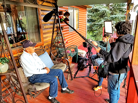
Interview with Mr. Joe Blea, a third-generation resident of Gallinas, New Mexico. Mr. Blea’s grandfather knew Giovanni Maria de Agostini.

“Hermit of Las Vegas” film crew preparing to climb Hermit’s Peak, Las Vegas, New Mexico.

View from the top of Hermit’s Peak, Las Vegas, New Mexico.
In 1869, Agostini was murdered at “La Cueva,” the cave in the Organ Mountains’ Dripping Springs Natural Area. He is buried in the Mesilla cemetery.

Shooting the documentary “The Hermit of La Cueva” at Giovanni Maria de Agostini’s grave, Mesilla, New Mexico. Left to right: Marcia Paraiso, Film Director, Ralf Tambke, Director of Photography, Juliana Baratieri, Sound Engineer (Realizart Productions Audiovisual LTDA).
Sunday, January 29th, 2017
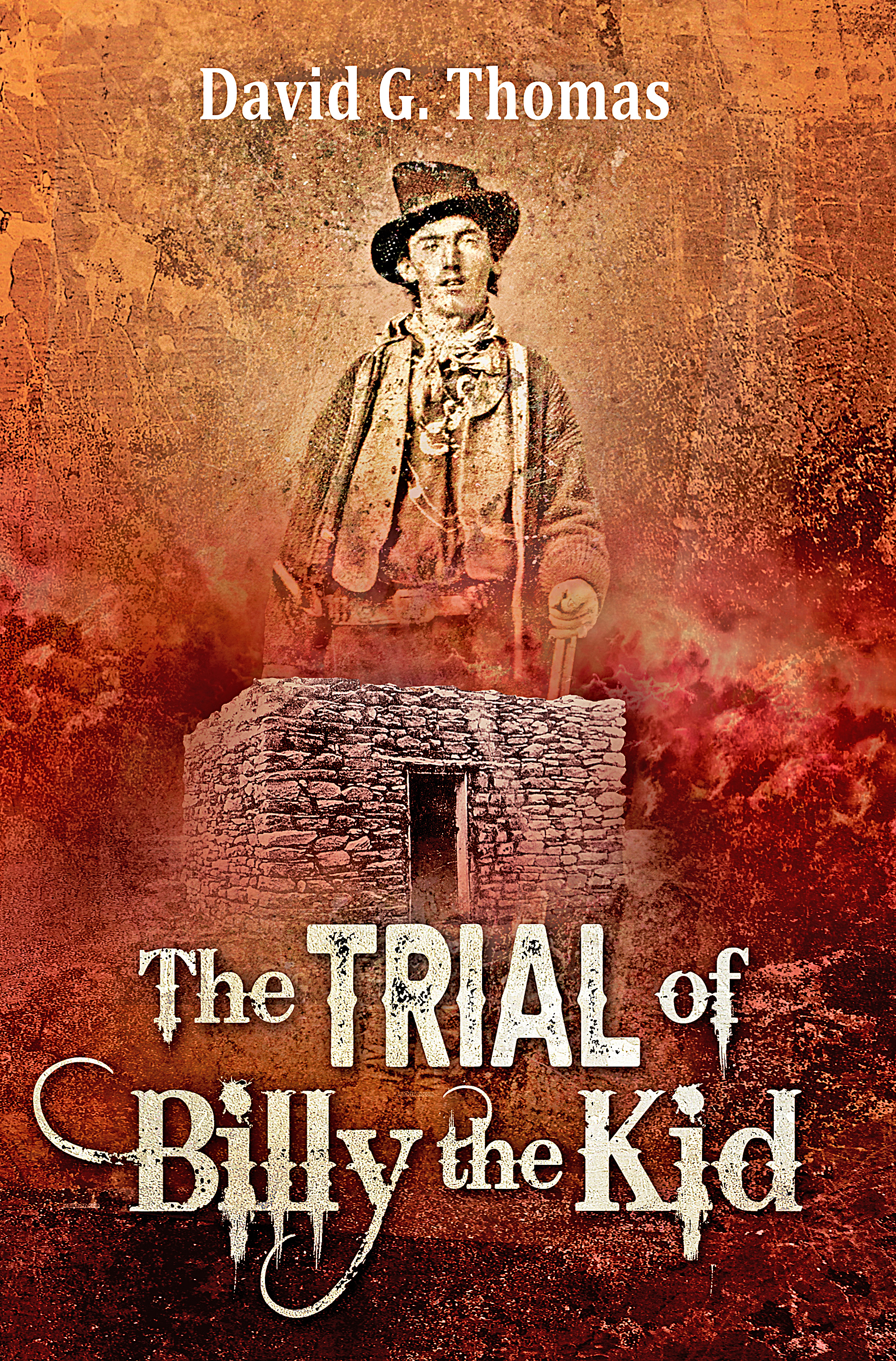
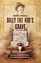
Billy the Kid’s Grave – New Book
Billy the Kid’s Grave – A History of the Wild West’s Most Famous Death Marker

“Quien es?”
The answer to this incautious question – “Who is it?” – was a bullet to the heart.
That bullet – fired by Lincoln County Sheriff Patrick F. Garrett from a .40-44 caliber single action Colt pistol – ended the life of Billy the Kid, real name William Henry McCarty.
But death – ordinarily so final – only fueled the public’s fascination with Billy the Kid.
What events led to Billy’s killing? Was it inevitable? Was a woman involved? If so, who was she?
Why has Billy’s gravestone become the most famous – and most visited – Western death marker? Is Billy really buried in his grave? Is the grave in the right location?
Is it true that Pat Garrett’s first wife is buried in the same cemetery? Is Billy’s girlfriend buried there also?
The Fort Sumner cemetery where Billy’s grave is located was once plowed for cultivation. Why?
What town, seeking a profitable tourist attraction, tried to move Billy’s body, using a phony relative to justify the action?
These questions – and many others – are answered in this book.
The book is divided into three sections. The first gives an account of the chain of events that led directly to Billy’s death, beginning the singular event that started the sequence, Billy’s conviction for murder and his sentencing to hang. As much as possible, these events are related using the actual words of witnesses and contemporaries. The second chapter tells the story of Billy’s burial and the many surprising incidents associated with his grave over the years. The third chapter lists the 111 men and women known to be buried along with Billy in the Fort Sumner cemetery, with short biographies. Sixteen of these individuals had very direct connections with Billy. Appendix A supplies Charles W. Dudrow’s correspondence regarding the locating and disinterring of the military burials at Fort Sumner. Appendix B reprints the only newspaper interview ever granted by Sheriff Patrick F. Garrett on the killing of Billy the Kid.
To supplement this history are 65 photos and illustrations. These include photos of the different memorials that have marked Billy’s grave over the years, including a photo of Billy’s previously unknown second grave marker; pictures of the men – friends of Billy – who re-located the grave in 1931; pictures of Billy’s most likely girlfriend, Paulita Maxwell, and her parents; and a historic 1906 Fort Sumner cemetery map showing the location of Billy’s grave.
Paperback, 154 pages. Available from Amazon.
See Also:
Mesilla Museum Display
Billy the Kid Display – Mesilla
Saving the Pat Garrett Marker
Billy’s DNA
Old Mesilla Courthouse
Billy the Kid
Butterfield Overland Stage
Friday, September 16th, 2016
An Overland Stage Trip
The Overland Mail was created by an act of Congress on March 3, 1857, to convey mail between St. Louis, Missouri and San Francisco, California. The U. S. Postal Service contract to transport the mail was awarded to John W. Butterfield. The mail contract subsidized the creation of a stage coach line, permitting the Butterfield Company to ferry passengers, along with the mail, for a reasonable fare.
The first stage of the Butterfield Overland Mail left St. Louis on September 16, 1858. The planned transit time was 25 days, although once operation began, it was found that the trip could usually be made in just over 23 days. Stages left twice a week for the opposite end of the 2,800 mile route. The Overland Stage service to San Francisco ceased June 30, 1861, put out of operation by the start of the Civil War.
The following is a personal account of a trip on the Overland Stage that began July 21, 1860, at Madison, Arkansas and ended August 11 at San Francisco. The author, who doesn’t identify himself, published his account on September 27, 1860.
A Trip Overland
Having recently returned by the overland stage from a visit to the Atlantic States, and in compliance with a request and a promise, I will notice a few points of interest to some, at least, of the readers of the Democrat.
[On July 19] I bought two through tickets or seats in the overland stage, for which I paid three hundred and fifty dollars, with the privilege of carrying 50 pounds baggage to each passenger, but I had the good luck to bring a few extra pounds without charge.
On July 21, the writer boarded the Overland stage at Madison, Arkansas.
Some time elapsed in getting the passengers all seated and their baggage and trinkets well secured on the stage, which was a three seat Concord wagon. The usual call, “All aboard!” was given, and off we started, with ten passengers, only two of whom were booked through.
My introduction to overland staging was not pleasant; the night was uncomfortably warm, stage crowded, very dark, no lamps, and a green Dutchman that had never been on the road but once before, for a driver. Before we reached the five-mile house, we were thrown into confusion by having our stag capsized; fortunately no one was hurt. It was so dark that the passengers were compelled to pilot the craft through the heavy timber for several miles by carrying a light ahead. I began to think that Jordan was a hard road to travel, indeed. But soon the moon rose, and we made good time; the rest of the night passed pleasantly.
The morning of the 22nd found us running along at a lively pace, and in the forenoon we passed the little villages of Seaborn, Switzer and Clarendon; the latter on the left bank of White river. Passed the river, and followed up the west bank till we struck Grand Prairie. Crossed Grand Prairie, and passed the thriving little town of Brownville, late in the evening. We made poor headway during the night, landed on the left bank of the Arkansas, opposite Little Rock, at 1 a.m. on the 23rd. Here we were compelled to stay until daylight, as the ferryman refused to ferry us over at that hour. We made ourselves as comfortable as possible under the circumstances, the balance of the night. Some of the passengers stretched themselves out on the dry sand and were soon in the arms of a Morphy, at the mercy of myriads of mosquitoes. The seats in the stage were generously left to the comfort of the lady passengers.
Our number now comprised six passengers, the diver and a conductor. The day passed off pleasantly, after repeated halts and changes, considering the extreme heat and dust endured. Late in the evening we passed Lewisburg, a small town on the left bank of the Arkansas river. Traveled up the river all night, and crossed at daylight on the 24th at Dardanelles. Nothing of interest to note. Passed Charleston in the evening, arrived at Fort Smith at 2 a.m., on the 25th, after a drive of four nights and three days, and seventeen changes of drivers and horses. Met two overland stages going East, between Madison and Fort Smith. I put up at the City Hotel; a miserable shift to bear the name of a first-class hotel, and to receive the patronage it does. Here I remained until the 27th, waiting for the mail which left St. Louis on the 23rd.
The morning of the 26th, my time was employed in preparing little necessaries of the long journey; and soon after the arrival of the stage with the St. Louis mail, all was ready, and out we rolled, with three passengers, one way passenger, conductor and driver. At 11 a.m., we crossed the little river Porto, the boundary between Arkansas and Indian Territory. The first fifteen miles after we crossed the Porto was dense forest of timber and thick cane brakes, with an occasional field of corn – the best of any I saw on the whole route. Before we got off the fertile bottoms of the two rivers, Porto and Arkansas, we had a good share of what one of our passengers called “corduroy roads,” not at all agreeable to one opposed to being jolted.
July 27th. We passed Mountain station this morning at sunrise, traveled over some rough road; extremely hot; crossed two high bridges, call Boggy Bridge and Muddy Boggy; passed Boddy depot late in the evening, a small village of some dozen or fifteen houses, neatly put up, with a respectable brick church. This town is in the Chickesaw Nation and is surrounded by a rich and productive country.
We crossed Red river at daylight on the morning of the 28th, and took breakfast at Sherman, Texas, a promising little town, surrounded by a beautiful and fertile country. Here we changed stages again, and rolled off at a lively pace, with a new conductor and only three passengers. We had a new driver at every change of horses, which ranged from ten to twenty-eight miles apart. Passed Whitestown in the forenoon, and Gainesville in the afternoon. This is the county seat of Cook county, and is a flourishing town. Road very rough all night; passed Locksboro, at daylight on the 29th, a town of some importance, able to boast one newspaper called the White Man. Arrived at Fort Belknap at 1 p.m. Here we changed stages and conductors again. Our number increased to six in this change, but the road was fine and we made good time after crossing the Brazos; a wide channel, but bone dry at this season of the year. Crossed the Clear Fork of the Brazos, which had some water in its channel; traveled at a lively rate all night, over a beautiful plain, by a bright moonlight.
July 30th, made good time; level country, water scarce; one drive of thirty-five miles through a mountain pass – arrived at Fort Chadman at 4 p.m. Changed stages and conductors again crossed the Colorado river late in the evening (no water in the channel), and the Concha at 10 p.m., a bold stream but narrow. The road continues good, and water scarce. Passed two companies of U. S. troops early on the morning of the 31st. Water very brackish and scarce. We made one drive of 28 miles today, between stations, and another of 40 miles. Passed through Castle Mountain canyon late in the afternoon; quite a romantic spot, surrounded by some beautiful mountain scenery. Crossed the river Pecos at 10 p.m., another deep but narrow stream. We passed Camp Stockton at daylight on the morning of August 1st, a beautiful site. The buildings are all made of adobe brick. Another forty-mile drive today, some pretty mountains scenery in the distance; through Davis Pass, and arrived at Fort Davis at 6 p.m. Changed stages again, and were soon on the move, making good time over a fine road.
August 2nd, road continues good today, and water scarce; barren mountains on each side of the road all day. One drive of forty-two miles between stations today. Passed Ten-mile canyon, and landed at Camp Fargo at sundown. The distance between Camp Fargo and Eagle Springs is 42 miles, and has been traveled over twice in one day by the same team. The day I came through, the same team went East from Camp Fargo to Eagle Springs in the forenoon, and returned with our stage in the afternoon. This almost incredible feat was performed by five little mules. Camp Fargo is situated on the left bank of the Rio Grande. Here we had heavy sand to contend with. Passed Fort Quitman at 10 p.m.
Continued up the left bank of the river, through an old Mexican settlement to Franklin, on the opposite river from El Paso in Mexico. Here we changed stages again, dropped one of our passengers, and picked up one through passenger and two way passengers. Leaving with six passengers and a new conductor we continued up the river to Fort Fillmore, and crossed the Rio Grande at Mesilla at 12 o’clock at night. This town is in the Gadsden purchase, and built after the Mexican fashion, all of adobe brick.
We had a good day on the 4th. Changed stages again at Cook’s station, crossed Membres river at 3 p.m., within 25 miles of the new Piatto gold mines, situated near the head waters of the Gila and Membres rivers. Here I was shown about five dollars of placer gold, with some small specimens of quartz, the proceeds of five days panning, a very fine specimen of fine gold, round and heavy. One of our fellow passengers stopped at Membres station, to purchase of a Mexican, an animal of the dog species, claimed to be a native of Arizona. It is a prodigy, a nondescript. The gentleman’s object was to bring it to California and exhibit it. If the half we were told is to be believed, it will eclipse anything belonging to the animal kingdom that has ever been exhibited on the Pacific. We arrived at Doubtful Pass at 4 a.m. on the 5th, and at Apache Pass at sunrise, changed stages again. Crossed San Pedro river in the evening; heavy thunder showers all the afternoon.
Arrived at Tucson Arizona at 2 a.m. on the 6th. This is an old Mexican City of some importance. Changed stages again at Tucson, and got a new conductor. Crossed the 80 mile desert in the morning. Struck the Gila river at Pimo Station in the evening. Changed stages again, passed through the Pimo Reservation late in the afternoon. Crossed the 40 mile desert during the night, and reached the Gila Bend at sunrise on the 7th. Road continues down the left bank of the Gila, very rough and dusty. Crossed Texas Hill at night; arrived at Gila City at 10 a.m. on the 8th, a small adobe town, inhabited by Indians and Mexicans.
Passed Arizona City in the afternoon, and crossed the Rio Colorado river below Fort Yuma at 4 p.m. Changed stages again at the crossing, traveled down the river for fifteen miles through heavy sand, and continued all night, and all day of 9th and the forenoon of the 10th, on the great desert of the Rio Colorado. Deep sandy road, and water scarce. Passed through Devil’s canyon, and arrived at San Phillippi at 2 p.m., and changed stages at Oak Grove station, late in the evening.
We crossed St. Anna river on the morning of the 11th; traveled down a beautiful valley, well improved; passed through the thriving little town of El Monte and landed at Los Angeles at 2 p.m. Here we hitched onto a twelve-passenger Concord wagon, and our number increased to twelve passengers; with a new conductor and driver. Passed over Fremont’s Pass, and through San Francisco canyon during the night. Some very rough road and beautiful mountain scenery. Passed Fort Tejon, and through the canyon of the same name, in the forenoon of the 12th. Passed Tulare Plains in sight of Tulare Lake, to the left of the road and crossed Kern river late in the evening.
We arrived in Visalia City at 9 a.m., on the 13th; There we changed off our wagon for a genuine coach and took on five more passengers. Crossed King’s river at 12 p.m.; passed Fresno City and reached San Joaquin river at dark. We had some rough mountain road during the night; passed Mountain View early on the 11th; through the town of Gilroy, the valley of the same name, and arrived at San Jose at 2 p.m. Took on two more passengers, making nineteen in all. Passed through Santa Clara and landed at San Francisco at 9 p.m., in good health, and not much the worse for wear, after the long and fatiguing journey – nor yet sorry that it was ended.
It cannot, by any means be called a pleasant ride, to be rocked and jolted for twenty-three consecutive days and night; but I prefer the overland stage to the steamer, for several reasons. It is undoubtedly the safest route, and the chances for health are better. One is free from the terror of fire and flood, constantly felt on the ocean steamer, and the horror of sea-sickness, so much dreaded and suffered.
In the whole distance between Fort Smith and Los Angeles, I did not see a sick man among the passengers or those in the employ of the company, numbering over two thousand. For a good portion of the route the fare is rather hard for one accustomed to good living. We paid 50 cents a meal on the first part of the road, and once on the Rio Grande paid 75 cents. After we left Tucson, we paid 75 cents and as high as $1, through to Los Angeles; and 75 cents each meal from there to San Francisco. A man can go through, and live reasonably well on $30, by taking a few pounds of crackers, cakes and etc. for an occasional lunch.
The Eastern end of the route is supplied with American horses, and on the plains of Texas they drive Mexican or mustang horses; and between Fort Belknap and Camp Fargo, on the Rio Grande, they drive Mexican mules nearly all the way – five in the team, three abreast in front. From Tucson through this way, California horses are used, and five or six on one stage where the road is heavy.
It is hardly credible how fast they travel where the road is good; fourteen miles an hour is frequently made; 35 miles is often made in 4 1/4 hours. The distances between stations range respectively from 10 to 42 miles. In Arkansas, and on the Eastern end of the road, the drivers change at every station; but West of the Rio Grande, they drive from 80 to 125 miles. Much credit is due to the conductors and drivers on the whole route, for their sobriety, courtesy, and attention to the passengers.
I like the overland travel, and were I going to the Atlantic States this Fall, or any other time, I would prefer it to any other route.
Source: The Plumas Argus (Quincy, CA), September 27, 1860
See also:
Picacho — Forgotten Butterfield Stage Stop
Picacho Cemetery
Picacho — A Brief History
Picacho Peak
Rough and Ready — Butterfield Stage Stop
Trip to Mason’s Ranch
Stage Coach from Mesilla – Unfulfilled Promise
Mesilla Stage Coach – More
Saturday, February 20th, 2016
Fountain Theater – History
In April, 1912, Albert J. Fountain, Jr. applied for a business license to open a moving picture business in Mesilla. He gave the name of the theater as “The Fountain of Pleasure.†Prior to the theater showing moving pictures, the theater was used for dramatic plays and visiting vaudeville acts. This continued even after theater began showing movies.
Fountain had purchased the site for the theater for $125 on August 23, 1905, from trustees of the Home Mission Board of the Presbyterian Church, which had operated a church there since 1880. This is the same site used by the theater today, making the Fountain Theater the oldest operating moving picture theater in New Mexico.
Fountain operated the theater until 1916, when he went out of business. He resumed the theater business in 1919. In 1927, Fountain sold the site and theater. The new owner operated the theater until 1931, when he went out of business. In 1938, Fountain re-purchased the site and theater. In 1951, he closed the theater.

As an independent theater operator, Fountain always had great difficulty obtaining new movies on a timely basis. For most of the time between 1938 and 1951, Fountain showed Spanish language movies.
In 1963, the Las Cruces Community Theater (LCCT) obtained permission from the Fountain family to use the building for dramatic plays. This continued until 1977, when the LCCT moved to its current location, the State Theater in Las Cruces.
Following the exit of LCCT, the Fountain Theater resumed showing movies, becoming an “Art House.” The Fountain Theater was the only venue in the Las Cruces area where movies such as MIDNIGHT COWBOY, THE DISCREET CHARM OF THE BOURGEOISIE, and LAST TANGO IN PARIS were shown.
The present occupant, the Mesilla Valley Film Society, began showing films at the Fountain Theater in 1989.

The walls of the Fountain Theater are decorated with murals of historic Mesilla scenes painted by Albert J. Fountain, Jr.
Source: Screen With A Voice — A History of Moving Pictures in Las Cruces, New Mexico.
See Also:
New Book on Las Cruces History
Mesilla Museum Display
Tuesday, November 24th, 2015
New Book on Las Cruces History
Screen With A Voice – A History of Moving Pictures in Las Cruces, New Mexico
 The first projected moving pictures were shown in Las Cruces 110 years ago. Who exhibited those movies? What movies were shown? Since projected moving pictures were invented in 1896, why did it take ten years for the first movie exhibition to reach Las Cruces? Who opened the first theater in town? Where was it located? These questions began the history of moving pictures in Las Cruces, and they are answered in this book. But so are the events and stories that follow.
First movie shown in Las Cruces
First theater in Las Cruces
First talkie shown in Las Cruces
Invention of drive-in theater in Las Cruces
Opening of Rio Grande Theater
Impact of Great Depression on business
Raffle of six-week-old baby girl at Mission Theater
World premiere of first BILLY THE KID movie
Second world premiere of a BILLY THE KID movie
Arrival of Organ, Rocket, Fiesta, and Aggie Drive-Ins
Shooting of Clint Eastwood’s HANG ‘EM HIGH
There have been 21 movie theaters in Las Cruces – all but three or four are forgotten. They are unremembered no longer. And one, especially, the Airdome Theater which opened in 1914, deserves to be known by all movie historians – it was an automobile drive-in theater, the invention of the concept, two decades before movie history declares the drive-in was invented.
To supplement this history are 102 photos and illustrations. These include ephemeral documents such as the 4-page flyer for Las Cruces’ third movie exhibition, at the Rink Theater; historic photos of theaters; aerial photos of drive-ins; and never-before-published photos of the shooting of HANG ‘EM HIGH.
Cover: Depicts the 1930 world premiere of BILLY THE KID, starring John Mack Brown as Billy, at the Rio Grande Theater in Las Cruces.
See Also:
Fountain Theater – History
Mesilla Museum Display
Wednesday, August 6th, 2014
New Book on the Hermit of La Cueva РEl Ermita̱o
Giovanni Maria de Agostini, Wonder Of The Century — The Astonishing World Traveler Who Was A Hermit
 This book is about a remarkable man, Giovanni Maria de Agostini, born in Italy in 1801, who combined two seemingly contradictory aspirations: a fervent desire to devote his whole life to “perfect solitude†and an astonishing urge to travel incessantly.
As his decisions and actions emerge from the lightless silence – the time-covered past – a unifying purpose becomes evident.
Following extensive travel in Europe, Agostini takes vows revocable only by formal dispensation from the Pope. He immediately leaves forever his “beloved Italy†for South America. Twenty-one years he spends traversing that, at the time, greatly unexplored continent, visiting Venezuela, Colombia, Ecuador, Bolivia, Peru, Brazil, Argentina, Paraguay, and Chile – and so doing multiple times. During this spectacular solo Odyssey, he survives a trip down the Amazon River by canoe, crosses the Alps by foot several times, walks vast distances, and endures living alone in scalding deserts and subzero mountains. In spite of oppressive and infuriating obstacles, including death threats, unjust arrest, deportation, jail, and forced confinement in a mental asylum, Agostini persists undeterred in the solemn goal he set for himself when he left Europe.
Seeking change and another continent, Agostini leaves South America for Mexico, passing through Panama and Guatemala, and then Mexico for North America, passing through Cuba. In Cuba, he is hailed as an extraordinary adventurer, his photograph is taken, and he is proclaimed “The Wonder of Our Century.†After arrival in New York, he walks to Canada, where he spends almost a year, then “goes west,†eventually reaching, in the midst of the American Civil War, the Territory of New Mexico, where he meets his merciless fate.
Agostini is remembered in many places — in South America as Monge João Maria, in North America as Ermitaño Don Juan Agostini; however his life story is encrusted with myth and false fact. As the veritable events of his life are unveiled, a man of fascinating originality, prodigious endurance, intelligence, self-discipline, and self-sufficiency, infused with an indomitable spirit of adventure, emerges.
Today in Argentina, as many as 15,000 people participate in a yearly festival initiated by Agostini at Cerro Monje, “Monk’s Hill.†In Brazil, at Cerro Campestre, “Campestre Hill,†and Santo Cerro do BotucaraÃ, “Holy Hill of BotucaraÃ,†over 10,000 people celebrate annual events founded by Agostini. In Lapa, Brazil, a national park protects the pilgrimage route to Gruta do Monge, “Monk’s Grotto.†At Araçoiaba Hill, near Sorocaba, Brazil, the Trilha da Pedra Santa, “Trail of the Holy Rock,†is climbed annually by thousands of people desiring to pay respect to the memory of the Monge do Ipanema, the “Monk of Ipanema.â€
These are just a few examples of Agostini’s cultural legacy, 145 years after his death.
“David G. Thomas has finally pulled back the veil of obscurity that long shrouded one of the most enduring mysteries in New Mexico’s long history to reveal the true story of the Hermit, Giovanni Maria de Agostini. Tracking Agostini from Italy throughout South and North America to his final resting place in Mesilla, Thomas has once again proven himself a master history detective. Of particular interest is the information about the Hermit’s life in Brazil, which closely parallels his remarkable experience in New Mexico, and required extensive research in Portuguese sources. Thomas’s efforts make it possible to understand this deeply religious man.†— Rick Hendricks, New Mexico State Historian
20 maps and 65 photos, including 2 rare photos of Agostini, one taken in 1857 and one taken in 1861.
Table of Contents here.
E-Book here
Wednesday, September 18th, 2013
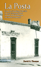
Did Billy the Kid Stay at La Posta in Mesilla?
“Best history of Mesilla.”
“La Posta: From the Founding of Mesilla, to the Corn Exchange Hotel, to Billy the Kid Museum, to Famous Landmark” consists of 5 sections:
- Chapter 1 is a history of Mesilla, beginning with its founding in 1850 by Rafael Ruelas.
- Chapter 2 gives the original and early ownership of all the properties around the public square in Mesilla, identifying previously uncertain locations such as the Butterfield Overland Stage location.
- Chapter 3 is a history of the Corn Exchange Hotel, founded in 1874, the most famous hotel in New Mexico at the time. Almost all the major participants of the Lincoln County War stayed at the hotel.
- Chapter 4 is a history of the Billy the Kid museum and its founder, Mesilla pioneer and impresario George Griggs.
- Chapter 5 is a history of La Posta, Mesilla’s most famous landmark.
“Mesilla is full of Billy the Kid history. It’s where he started off rustling with Jesse Evans and it’s where he was tried and convicted of murder. At one point, rumor has it, he even stayed at the Corn Exchange Hotel (along with many of the other heavy hitters from the Lincoln County War).â€
“For someone who grew up in the area of Mesilla, it’s nice to have a well-researched book about the area — and the giant photographs don’t hurt either (honestly, I love to see photos that take up the whole page so you can actually make out the detail)….â€
“And the thing I was most excited to see is a photo of the hotel registry where the name of “William Bonney†is scrawled on the page. I knew this registry had existed at one point but I always thought it was missing…. There is some debate as to whether or not Billy the Kid really signed the book, which the author goes into, but what would Billy the Kid history be without a little controversy.â€
– Billy the Kid Outlaw Gang Newsletter, Winter, 2013
See also:
Billy the Kid’s Grave
Mesilla Museum Display
Billy the Kid Display – Mesilla
Saving the Pat Garrett Marker
Billy’s DNA
Old Mesilla Courthouse
Billy the Kid
Butterfield Overland Stage
Saturday, June 8th, 2013
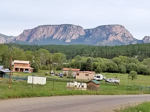
Trip to Mason’s Ranch
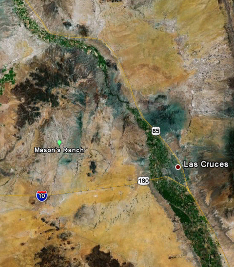
The site known as Mason’s Ranch or Slocum’s Ranch is about 20 miles west of Las Cruces and 10 miles north of Hwy 10. From 1862 to 1883, it was a life-saving lodging and watering stop for travelers heading west from the Mesilla Valley.
The site has natural water that is available part of the year, most years. Prior to 1862 it was known as “Water Holes” and had been used by Native Americans as a camping and watering spot for hundreds of years.

In 1862 Virgil Mastin built a stage stop on the site. The site was not a stop for the Butterfield Overland Mail Stage Line, but was for subsequent stage lines. As the satellite image above shows, the site is a short distance south of the old Overland Stage route. When the Civil War started, the Federal government, which had contracted with the Butterfield Overland Stage to carry mail, ordered the company to sell or recover its property and cease operations. The agents of the company sold their Mesilla properties on May 18, 1861.*
Mastin installed water tanks for supplying water when the springs were dry. When these tanks could not be filled from the local water, he hauled water by wagon from Mesilla. He also dug a large dirt reservoir to save rain water.
In 1865-66 Mastin took on John D. Slocum as a partner. Slocum had been running the stop for some time as an employee of Mastin.
On May 18, 1868, Mastin is killed by Indians. He was traveling to Pinos Altos by buggy, accompanied by two men on horseback:
“The horsemen stopped behind to allow their horses to drink at the crossing of Whiskey Creek, and Mr. Mastin drove on slowly, and when fired upon by the Indians was about half a mile beyond the creek and three miles from Pinos Altos. The horsemen hearing the firing rode up and fired upon the Indians – some forty in number – who were on foot and all after Mr M. who had turned his buggy about and was trying to get back into the road with the intention of running this way, but, unfortunately for him, just as he got back into the road the buggy turned over and threw him out when he was shot full of holes….”**
Slocum buys Mastin’s half of the stop from his estate on March 1, 1870, for $258. Slocum expands the stop with additional structures and corrals and calls it Slocum’s Ranch. The 1870 census shows Slocum, age 40, living at the stop with his wife Jesusa, 28, and two children Louis, 3, and John, 1. Two employees also live there, John Perry, 32, and John Brown, 26.
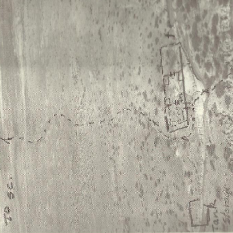
The design of the stage stop is marked on the aerial photo above, taken by Keith J. Humphries in 1974. As indicated, the south section contained rooms, the north section two large corrals. All were protected by an adobe wall. The reservoir is south of the walled structure. Even though the site continues to degrade, you can still see the outline of the stop in this recent satellite photo:

On October 25, 1875, Slocum leases the stop to Richard S. Mason for $75 a month. Mason advertises in the Mesilla paper:
“TRAVELLERS, ATTENTION!
R. S. Mason having leased the place heretofore known as
SLOCUM’S RANCH
situate 25 miles west of Mesilla on the road to Silver City and the west, informs the public generally that he is prepared to receive and accommodate travellers, and to supply passing trains or herds of animals with water.
This is the only watering place between the Rio Grande and Fort Cummins. I always have an abundance of water on hand, which I will furnish at reasonable rates.
My table will be kept supplied with the best the market affords.
I have pleasant and comfortable rooms furnished with clean beds for the use of travellers. Also comfortable and secure stabling for animals. I always keep a good supply of hay and grain on hand.
Travellers will find at my place everything requisite to supply their wants and add to their comfort, my charges will not be found unreasonable.
R. S. Mason”***
Mason ran into financial trouble in 1879, borrowing money that year, and by 1884 had abandoned the site.
Some images as the site appears today:

(Above) Looking at the northeast corner of the compound. The rock structure served two purposes: to retain the dirt fill necessary to level the corral and as the foundation of the adobe wall surrounding the stage stop. Note the erosion.
Looking at the base of the foundation.

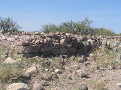
Looking south along the east wall. You can see the ruins of the housing section of the compound in the distance.

The housing ruins. Note the rock portion of the standing wall. The part of the structure used as a fireplace was rocked, the rest of the structure was adobe.
*La Posta – From the Founding of Mesilla, to Corn Exchange Hotel, to Billy the Kid Museum, to Famous Landmark, David G. Thomas, 2013.
**Santa Fe New Mexican, June 2, 1868.
***Mesilla Valley Independent, Oct 13, 1877.
See also:
Picacho — Forgotten Butterfield Stage Stop
Rough and Ready – Butterfield Stage Stop
Monday, June 18th, 2012
Rough and Ready – Butterfield Stage Stop
Rough and Ready was the second stop of the Overland Mail Stage Line after leaving Mesilla. (The first stop was Picacho.)
The Rough and Ready station is on the west side of the Rough and Ready Hills. Upon leaving Picacho, the trail led through Box Canyon north of Picacho peak, across flat tableland, and then through a pass to the station, as shown below. The hills to the north of the pass are the Sleeping Lady Hills, to the south the Rough and Ready Hills. The distance as traveled by the trail is about 15 miles. Traces of the trail are still easily seen in damage to the terrain and wagon-wheel wear-marks in rocks.
Here is a close view of the station location:

If you climb the summit above the station, you see Picacho Peak in the distance (circled) and the environmental disturbance due to the trail:

In the foreground of the photo above is one of the cairns established by the Bartlett-Conde* survey to mark the border between Mexico and the United States. Following the end of the Mexican-American war in 1848, both countries agreed to a joint survey to establish the border. The survey was to start at El Paso del Norte and go west. Because of a bad map, the starting location was mistakenly set 42 miles north of where it should have been. This mistake put Mesilla in Mexico and led to a nasty border dispute that was only settled by the Gadsden Purchase of 1853. The map below shows the mistaken area (click for a larger map):

There is little left of the Rough and Ready station. Many of the still visible ruins are likely of a later date. An archaeological excavation established that the station consisted of a two-room stone and adobe house with chimneys and a large adobe corral. There was no water source at the station. A dirt tank was dug to capture rain water and water was also hauled from Mesilla.
Here are some ruins:

Here is one of the stakes marking a corner of the archaeological excavation:

There is a mysterious burial or memorial of unknown origin a short distance from the old station that reads “Stubs, RIP.” It has no date, but can not be more than 20 years old. If you have any information on this cement marker, please communicate it.

*The lead American surveyor was John Russell Bartlett, the lead Mexican surveyor was Pedro Garcia Conde.
See also:
Picacho Cemetery
Picacho – A Brief History
Picacho Peak
Picacho — Forgotten Butterfield Stage Stop
Trip to Mason’s Ranch
Tags: History, Mesilla, Stage Coach, Butterfield Overland Mail